
International Seismological CentreHenry Spall talks with the Director, Anthony Hughes |
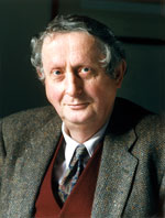 Anthony Hughes |
 |
This article is courtesy of Earthquake Information Bulletin
September-October 1979, Volume 11, Number 5 published by the United States Department of the Interior Geological Survey |
The International Seismological Centre had its origins when the British Seismologist Professor John Milne returned to England from Japan in 1895 to retire at Shide on the Isle of Wight. In cooperation with the British Association for the Advancement of Science, Milne had set up a number of seismographic stations around the world and, while in Tokyo, had published a Catalogue of 8,331 Earthquakes Recorded in Japan, 1885-1892.

|
| Kew Observatory, England , headquarters of the International Seismological Summary for a time. |
Milne, in effect, organized a prototype network of worldwide standard seismic stations. The observations from this network formed the Shide Circulars sponsored by the British Association for the Advancement of Science. These were established as the International Seismological Summary (ISS) by the Rome meeting of the International Union of Geodesy and Geophysics in 1922.
|
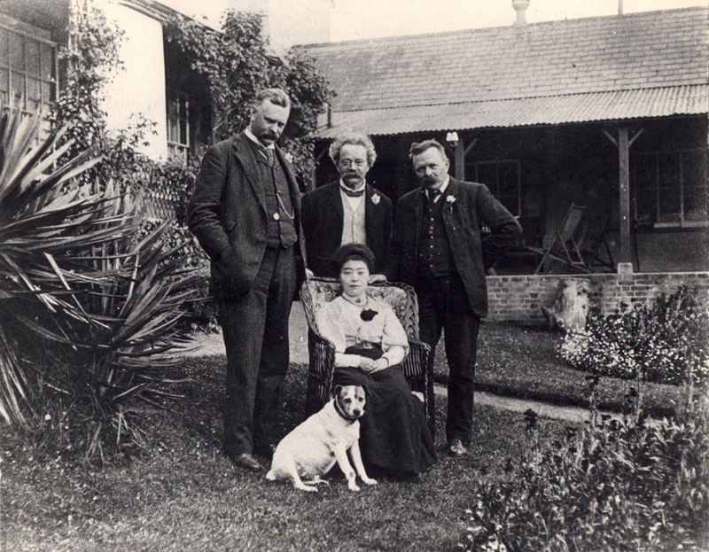
| Professor John Milne ( right) with his wife at Shide , Isle of Wight, in 1900. Professor H.H. Turner is on the extreme left. |
The first director of ISS was H. H. Turner, Professor of Astronomy at Oxford. First and foremost an astronomer, Turner had considerable seismological interests and was the discoverer of deep-focus earthquakes. In 1922, the chief interpreter of the ISS was J. S. Hughes, who remained in that capacity until 1965. His son, Anthony Hughes, is the present director of the International Seismological Centre, which is now located in Newbury, Berkshire, England.
|
“Quite apart from being very good and industrious at his job of manually determining epicentres, my father did two other important things. First, when Turner died in the 1930`s, he was the continuity in the changeover to the new director, Sir Harold Jeffreys. Sir Harold was the honorary director while my father was the working assistant director. Second, in these early days there was very little financial support for ISS. Had it not been for my father`s extreme dedication and personal resources, the Summaries would never have been produced. “ “Before 1963, the ISS was run really on a shoestring. True, there was some funding from the United Nations Educational, Scientific and Cultural Organization, and it had the backing of seismologists in the International Association for Seismology around the world. But it relied mainly on the efforts of J.S. Hughes to keep it running.” The next director, Robert Stonely, took over from Jeffreys in 1951. After P.L. Willmore became director in 1960, the ISS was superseded in 1964 by the International Seismological Centre (ISC), which was headquartered at the University of Edinburgh, Scotland. E. P. Arnold, now with the U.S. Geological Survey, became director in 1970 and supervised the move to the present quarters at Newbury in the south of England. The ISC became an international body after the reorganization in 1970. It now has financial support from agencies in 37 countries. The ISC has several important functions. “Our main aim is to collect every observation of an earthquake that is made at stations around the world and then combine them to produce the definitive earthquake catalogue. We also want to make the data available in some sort of computer readable form. That doesn`t mean to say that we are duplicating the work of the other seismological services, such as the National Earthquake Information Service (NEIS) in the United States. We are actually complementing them.” There is, however, an important difference from other cataloguing services. |
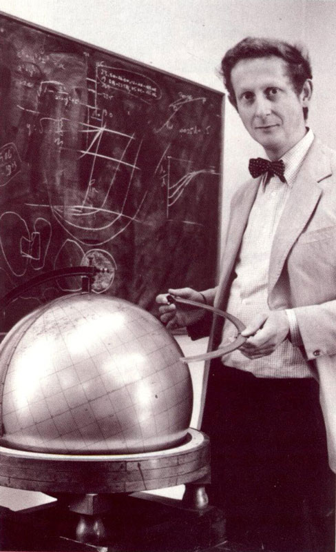 Anthony Hughes, present Director of the International Seismological Centre, with the globe used by his father for 22 years to calculate the epicenters of worldwide earthquakes. Anthony Hughes, present Director of the International Seismological Centre, with the globe used by his father for 22 years to calculate the epicenters of worldwide earthquakes.
|
“ISC provides the final collection and analysis service for world seismological data. We wait 22 months before we close our files. During that time we are continually updating our records and increasing our data files so that we probably end up with twice as many observations as any other agency. For instance, we publish almost three times the number of earthquakes that NEIS does. The reason for the 22-month delay is obvious. First, we are seeking completeness and must be prepared to deal with every possible event that has been recorded. Second, the delay allows final observations from very remote stations to be used.
“Throughout those 22 months, data are funnelled into ISC in a variety of ways such as station bulletins, TELEX reports, magnetic tapes, punched cards, paper tape, and preprinted coding sheets.
“I`m afraid we`ve even had observations on postcards and the back of envelopes. This sort of informal communication can sometimes be extremely valuable. For instance, on some of the station bulletins there will be very important asides such as the instruments were particularly noisy or large surface waves were recorded or there were power fluctuations while a particular earthquake was being recorded. A large proportion of felt and damaging reports come from station bulletins.”
Another reason for the 22-month delay is the inaccessibility of some of the stations, especially those in the South Pacific and the Antarctic (for example, Mawson Base). Nevertheless, such records are extremely important for locating earthquakes in the Southern Hemisphere. The data are keyboarded into a common format and entered into the files. An average month`s worth of data contains anywhere from 65,000 to 100,000 observations. “That`s why any help we can get from the actual contributors in providing their data in computer readable form is very valuable.”
Data reported to ISC, in addition to phase onset times at stations, consist of epicentres ( involving a time, latitude, and longitude) usually determined from the first onset of primary waves. Magnitudes are generally included although, on occasion, it is difficult to know how the magnitude was calculated. There may be as many as six different agency estimates of the same earthquake. Additionally, there may be amplitudes, periods, a comment or two, intensity data, and other macroseismic information.
“We report as much as possible because we realize that, in the end, if station bulletins and records are lost, the only observations that will hopefully endure will be in our ISC publications.”
“The Soviet stations, over 100 of them, are one of the major contributors to ISC. Their data come from two sources-the basic stations run by the Academy of Sciences from Moscow and separate networks of seismograph stations in other regions of the U.S.S.R.
Unfortunately, there is no universally accepted format for reporting earthquake data. (”I wish there were. Efforts are being made in this direction.”) Standardized data sheets are sent out, especially for stations that can only report in this way.
There is no cutoff magnitude in the ISC scheme. All the data that are received are published. Some agencies, such as those in Japan, have great numbers of events, so they will generally only supply observations on earthquakes larger than about ML=4.0, which the Japanese refer to as class A and B events. But events much smaller than that, for instance, from California, are published.
“We duly report them, for the sake of completeness and as an obligation to those who have troubled to supply them.” How many stations will be used in reporting a particular earthquake? This really depends on how large the event is. If it is magnitude 6.0 and above, ISC may have records from 500 stations or more. This represents several thousand observations because many stations will report not just the first arrival but subsequent phases, too.
“We don`t receive or store seismograms. There`s absolutely no way we would have the facilities to store them, and more important, we don`t have the resources or the people to analyse them.
“In a sense we assign reliability to certain sets of data. It is well known that the errors in seismological observations are not normally distributed, so we did not use the usual statistical method of “least squares” which assumes normal distribution for epicentral determination. We adopted Jeffreys` Method of Uniform Reduction, a variant on “least squares”. This procedure weights each observation according to its fit against the preliminary determination and the distribution of all the observations being used in the calculation. Jeffreys` method is a means of making the seismological observations look normally distributed. It also speed up the rate of convergence of solutions of epicentres considerably. The reliability of these solutions is indicated by the inclusion of standard errors.”
Anthony Hughes is the editor of both the ISC Bulletin and the Catalog. The Regional Catalogue of Earthquakes contains all the summary information about each event that has been published previously in the Bulletin of the International Seismological Centre; each Catalogue includes the events from 6 months of Bulletins. This means that he looks through the records for the particular month under consideration (22 month in arrears of real time) after initial processing. The computer sorts out events into chronologically ordered records that will eventually be printed by an automatic typesetting machine. The Catalog is organized by (1) major events in three depth categories, (2) felt and damaging earthquakes, (3) lists of probable explosions, (4) all earthquakes by regions, and (5) station lists.
There are, however, potential sources of error.
“Very often ISC will get the same event reported through different channels. For instance, data from some stations may go first to NEIS where they appear in the Preliminary Determination of Epicenters (PDE). Based on the PDE, these same stations will then reread their records. This leads to ISC receiving duplicate preliminary and final observations. The main problem, of course, is to keep track of which are the final observations. It is important for stations to realize that publications like PDE are meant to be preliminary; they`re a guide so that stations can analyse their own records more profitably.”
Another problem in the monthly listing can occur when the computer inadvertently mixes local events with data from a remote earthquake simply because the origin time of the teleseism is consistent with the observations of the local events. Here Hughes checks through every event in the computer`s printout and deletes such local and false shocks. All earthquakes are relocated by ISC if there are adequate observations. The computer also makes a routine search for new events from the unassisted observations. There is also a routine search by the computer of unassociated observations for new events.
With no universal agreement on reporting earthquake information, there are decisions to be made about presenting data. Magnitude is a problem. There are five or six scales in use throughout the world.
“I wish we could accept a universal method. The Commission on Practice of the International Association of Seismology and Physics of the Earth`s Interior has been struggling with this problem for many years, and we hope that a decision is imminent. To get magnitudes for small earthquakes in the near field is particularly difficult.”
ISC publications are beneficial for many types of users.
“They are especially valuable for earthquake risk analysis. It`s really quite astonishing the number of firms-civil engineering and insurance-that use the Catalogs. They do so because we have the most comprehensive catalog of worldwide earthquakes back to 1918 (including the ISS). The Bulletins are used for constructing travel-time tables, for earthquake prediction, and for basic seismological research. The Bibliography of Seismology that we publish is a comprehensive listing of seismological literature and includes a section dealing with all papers relating to particular events. Our output is quite impressive when you consider our modest staff and resources.”
Other stories on the ISC history#colleagues-notes